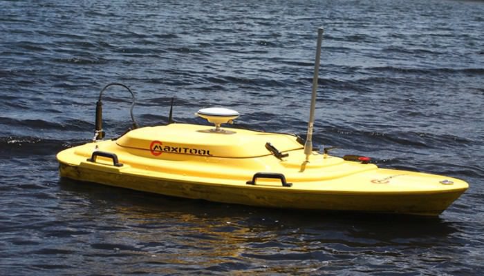
Maxitool Australia provide Bathymetric Surveying Solutions to the mining and water management industries. Our remote-control survey platform offers a safe and efficient method of mapping almost any body of water or liquids storage facility.
BATHYMETRIC SURVEYING
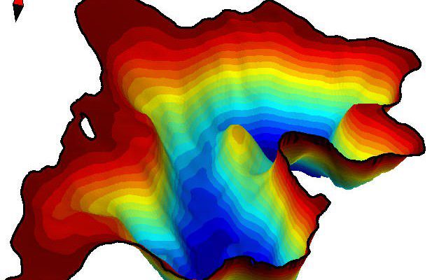
Cost-effective, innovative and accurate, this system enables us to measure current capacity levels of water storage facilities as well as clearly map bottom profiles. This data is often required for EPA and DERM compliance and reporting. We can survey almost any on-shore body of water, not limited to process water ponds, open cut pits, tanks and acidic, alkaline or otherwise hazardous liquid storage facilities.
Key features of our survey solution are:
- Remote controlled with a range of up to 1200m
- Portable and efficient mobilisation
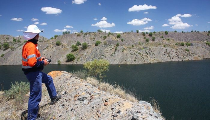
- Operator works from bank and not over water
- Ideal solution for dangerous and hazardous environments
- Data collected from 0.3m up to 100m depth
- Data reports can include bottom profile, surface area and water volumes
- Data outputs: 2D, 3D, DXF, CSV and TXT
- Surveys can be conducted both before and after dredging or excavation works.
SAFETY
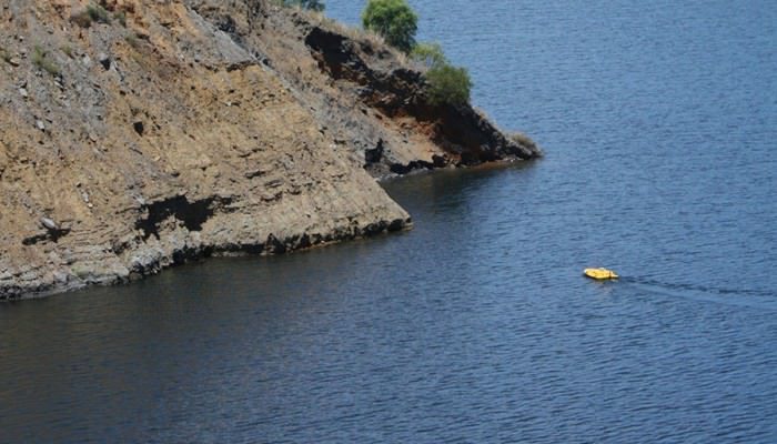
Our remote-controlled survey platform scans the bottom while transferring live data back to the operator station onshore. This method can deliver the same results as traditional bathymetric surveying without the hazards associated with personnel working over water. As the survey platform is unmanned it also enables the operator to map hazardous areas such as exclusion zones below highwalls.
Our team have extensive experience working on and around water on mine sites. We have a clear understanding of the statutory and industry specific safety management requirements. Our survey solution includes preparation of all relevant safety management documentation required on site.